
Agency9 is a leading provider of software for online visualization for urban planning and GIS applications. With a mission to make 3D visualization simple and accessible for urban development, its latest capacity is to deliver entire global cities in 3D digital models within a matter of weeks.
CityPlanner—3D Cities Anywhere in the World
Agency9 is announcing the capacity to deliver “textured” 3D cities anywhere in the world with its CityPlanner, a subscription-based 3D web software.
This new capability is made possible via a partnership with DigitalGlobe. 3D cities are created using DigitalGlobe’s industry-leading global database of satellite imagery, containing more than 100 petabytes of data collected over the past 17 years. By means of this program, any city in the world can be made available in CityPlanner within a few weeks.
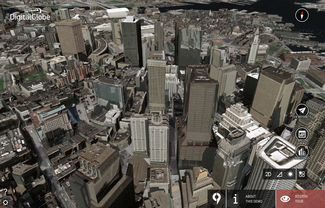
01 – An image of Boston’s urban section in CityPlanner, a web-based software service that lets cities and professionals work with satellite-based 3D driven geometry with textures.
“Agency9 already serves many customers with web-based 3D visualization in CityPlanner, facilitating collaboration and citizen participation based on communicative principles,” says Håkan Engman, CEO of Agency 9 AB. “With this release of 3D cities in CityPlanner—enabled by DigitalGlobe imagery—any municipality in the world can easily begin their transition to 3D urban development.”
Continuing, he adds: “3D cities derived from satellite data have great potential. The quality is already good and will undoubtedly continue to improve.”
A New Generation of Urban Planning Tools
CityPlanner is fully web-based and is powered by HTML5 and WebGL. It runs plugin-free in any modern web browser. It represents a new generation of urban design tools and is used by both design professionals and municipalities for plan preparation, integrating GIS tools and analysis with CAD and 3D data. Crowd-sourcing and citizen dialog tools include 1-click publishing and dialog forms.
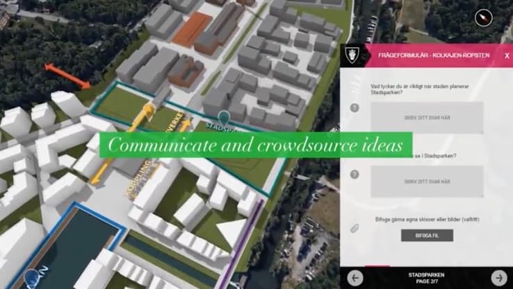
02 – CityPlanner supports stakeholder participation via 1-click publishing and stakeholder forms and crowdsourcing capabilities.
CityPlanner comes with a free global 3D model created with LOD1 (level of detail 1) building data via OpenStreetMap and a Digital Terrain Model (DTM) based on open satellite data. Buildings are currently available in the Nordic countries, expanding worldwide throughout the year.
Availability and Pricing
CityPlanner is available as a subscription service starting at 220.euro per month. By updating to Enterprise price plan customers can expand users and capacity, as well as use their own 3D data—including highly detailed textured city models, to suit any organization’s needs. A free 30-day trial is available.